Do you ever look at field photos in AutoCAD and wonder what they are, the location, or even why the heck you took them in the first place?! PhotogeoDWG Pro helps alleviate all of those questions.
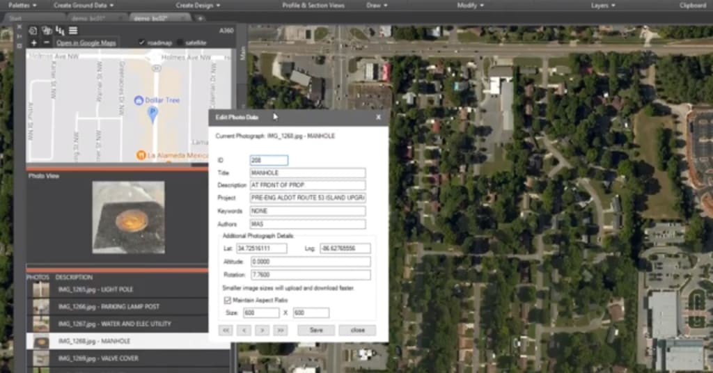
According to the developer: “Whether you are walking miles of roadway to capture existing conditions, documenting sidewalk accessibility, or working on a signage inventory PhotogeoDWG can instantly build your documentation and help when you want to share with your design team. PhotogeoDWG assists by showing you the location where you took the photo with a marker rotated to match the orientation you were standing when you took photo. The app will place a raster reference of the photo in the drawing, and it will automatically insert labels into your drawing.”
A free 30-day trial is available on the Autodesk App Store.
Check out the entire series for more AutoCAD apps available on the Autodesk App Store.
Source: Autodesk