Looking to take advantage of Google Earth in AutoCAD?
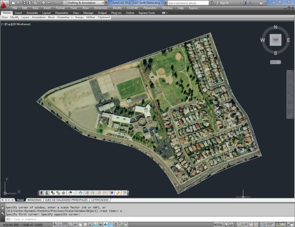
Available on the Autodesk App Store, CAD-Earth “is designed to easily import and export images, objects, and terrain meshes between Google Earth and AutoCAD,” as well as create dynamic contour lines and profiles.
The app boasts a wide array of additional capabilities, including:
- Import command fully optimized for speed and performance
- CAD entities exported to Google Earth grouped by layer name
- Drawing previews in the real world; move, scale and rotate in real time until they match the exact location
- Insert of geo-referenced images
- Slope zone analysis
- Profile and cross-section from mesh
- Extensive help section in each step
CAD-Earth offers a free 30-day trial and can be downloaded here.
UPDATE: Since the publication of this article, we have also featured how Plex.Earth 4 brings together AutoCAD, Google Earth, and Google Maps. You can read the article here or learn more about Plex.Earth 4 on their website.
Check out the entire series for more indispensable AutoCAD apps available on the Autodesk App Store.
Source: Autodesk