With the release of AutoCAD 2019, Autodesk brought together industry-specific features and capabilities for architecture, mechanical engineering, electrical design, and more into the AutoCAD platform, the industry-leading computer-aided design (CAD) software that architects, engineers, and construction professionals rely on to create precise 2D and 3D drawings.
Today, when you subscribe to AutoCAD, you get access to industry-specific toolsets, including the AutoCAD Map 3D toolset. Because the industry-specific toolsets are developed on the AutoCAD platform, any enhancements to AutoCAD are inherited by all the toolsets, Map 3D included.
Contents
What’s New
Map 3D continues to be the Autodesk solution for customers who want broad access to CAD and GIS data to support planning, design, and data management workflows. Using Map 3D, you can easily create, maintain, and communicate mapping and GIS information right within the AutoCAD drawing environment. With task-based tools, you can manage GIS data and aggregate it with design data.
With the release of the Map 3D toolset in AutoCAD 2020, we delivered new features to users, including a dark blue theme user interface option, support for additional Coordinate Systems, and extended support for FDO providers.

Connecting to ArcGIS
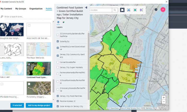
In that release, we also furthered our partnership with Esri to bridge CAD/design and GIS workflows by enabling support for the Autodesk Connector for ArcGIS in Map 3D. With this capability you can now use your Esri ArcGIS login to maintain a “live” connection between Map 3D and your ArcGIS data, enabling you to browse available GIS data and bring data layers into your Map drawing.

We’d Like to Hear From You
You can learn more about Map 3D toolset by visiting the product center or get access to even more tools and resources in the Autodesk Knowledge Network. We also encourage you to participate in the Map 3D beta program to get first-hand experience of upcoming enhancements and to provide direct feedback to Map 3D product development team.
Map 3D serves as a foundational component to Civil 3D and InfraWorks, Autodesk remains committed to supporting this product with the delivery of enhancements via new releases (including capabilities that will be inherited from enhancements in AutoCAD), updates, and fixes.
Whether you’re new to Map 3D and are just getting started by downloading and installing the toolset or you’re just brushing up on your skillset and in search of the latest Map 3D tips, our hope is that this blog continues to be a resource to you.
Source: Autodesk


